Uig in 1896 (Gazetteer of Scotland)
A description of the Parish of Uig in 1882/1896.
From the Gazetteer of Scotland,
Uig, a Hebridean parish of Ross and Cromarty, whose church stands near the W coast of Lewis, 34 miles W by S of the post-town, Stornoway. The parish includes the Flannan Isles, the islands of Bernera, Mealista and Paba, with some smaller islands. It is bounded N by the ocean and Barvas, NE by Stornoway, E by Lochs, S by Harris and Loch Resart, and W by the ocean. Its utmost length, from NE to SW, is 22½ miles; and its utmost breadth is 17 ¼ miles.
The Carloway detached portion of the parish of Lochs was divided by the Boundary Commissioners in 1891 between the parishes of Uig and Barvas – all to the west of a line running through Loch Langabhat, Loch Ghleadhairean, Loch Shanndabhat, Loch Mor Connaidh, and Loch Airidh Seibh, on till it reaches the boundary of Uig in Gleann Eiracleit, being transferred to Uig parish. The north-western division of the parish is cut into a labyrinth of islands and peninsulas by the numerous and intricate ramifications of Loch Roag.
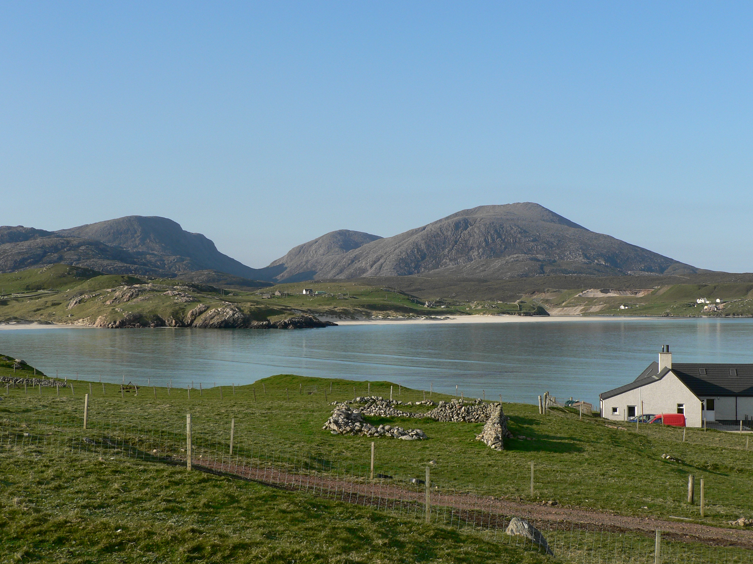
A large and comparatively little indented peninsula between that sea-loch and Loch Resart forms the south-western division, and sends out two prominent headlands, the most westerly ground in the island. Between these promontories, the more northerly of which bears the name of Gallon Head, and which are 3 miles asunder, occurs the Bay of Uig, the most important bay in the parish. This bay penetrates the interior to the exten of 3¼ miles, and has a mean breadth of about 1 miles; and while quite exposed, over 2 miles of its extent, to the tremendous westerly gales and surges of the Atlantic, it afterwards suddenly contracts, and then shoots out into a series of sheltered creeks.
Fresh-water lakes are very numerous in most parts of the interior, and reflect from their surface the brown, bleak features of dismal moors. The only noticeable one is Loch Langabhat (8½ miles x 7 furlongs), chiefly on the boundary with the aptly-named conterminous parish of Lochs. The lakes, excepting this one, rarely attain 6 miles in circumference; the abound with small trout; and oweing to the moorishness of the grounds which their feeders drain, their water has a brownish colour. There are four rivulets in which a few salmon are caught. The seas and bays on the coast abound with cod, ling, dogfish, coalfish, and most kinds of shell-fish, and are frequented by English vessels for supplies of lobsters.
Mealasbhal (1750 feet) is the highest of several hills that exceed 1500 feet above sea-level; but the parish generally, though loftier as a whole than any other in Lewis, exhibits throughout the interior a continuous assemblage of low hills and flat moors. Its seaboard is for the most part low, has a sandy soil, and contains nearly all the cultivated land. The soil of the interior is firth think, light, and the mixed with a little clay, and farther back almost wholly moss; yet it is largely capable of improvement, and with the aid of sea-weed for manure produces forced crops. The proportion which arable grounds and good pasture bear to the moors is little, if any, more than as 1 to 20.
At the head of Loch Road is a megalithic cruciform Druidical circle called the Circle of Callernish, but which is rather in the form of a Roman cross than a circule, although there is a circle to which the four arms of the cross lead. This Druidical temple is one of the largest and most complete of its kind in Scotland, while it, the one at Stenhouse in Orkney, and Stonehenge in England are the most remarkable in Britain. The total number of stones when the temple was complete was 65, of which 45 are still standing. These range from 4 to 13 feet in height, with one 16 feet high, and are placed on the long line of the cross, along the short line, and on the circle. In the immediate neighbourhood are several smaller circles, some of them being, however, as large at 50 feet in diameter.
At Mealista Uig, near the remains of an ancient nameless nunnery, were discovered some years ago about 60 beautifully executed ebony figures¹, some 4 inches long, evidently of very ancient manufacture, and supposed from their variety of form and shape to have been designed as chessmen. Notwithstanding the the remoteness of its situation, the parish was strongly affected by the change of proprietorship and the new system of improvement noticed in our article on Lewis; but, all the same, it subsequently figured prominently in the successful Crofter agitation.
Uig is in the presbytery of Lewis and the synod of Glenelg; the living is worth £208. The parish church was built in 1829 and contains 1000 sittings. There is a chapel of ease at Bernera, and there are two Free churches – the one of Uig, and other of Carloway. Eight public schools, with a total accommodation for 949 children, have an average attendance of about 670, and grants amounting to nearly £855.
Pop. (1801) 2086, (1841) 3316, (1861) 2878, (1871) 3143, (1881) 3489, (1891) 4621, of whom 4422 were Gaelic-speaking. Ord Sur sh[heet]s 104, 105, 98, 99, 1858.
1. The Chessmen were found on the sands at Ardroil, according to contemporary accounts, and are of walrus ivory, not ebony.
If you would to leave a comment or get in touch with us…
You can visit our facebook page Uig Historical Society where we will be able to contact you. We have a great facebook family who are always happy to help with anything from dates, photographs and any information regarding Uig.