Islands
St Kilda
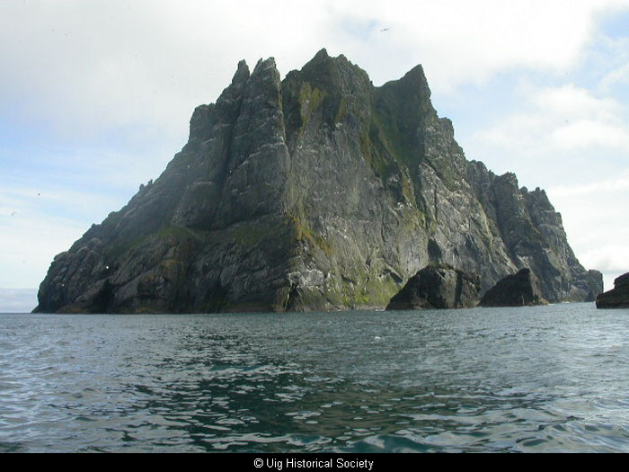
The small archipelago of St Kilda consists of five islands Hirta, Boreray, Soay, Dun and Levenish situated 40 miles west of the Hebrides.
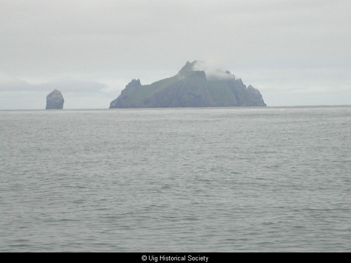
The sheer cliffs rise 1300 feet from the water and are the highest seacliffs in the UK. The name may not refer to a saint but rather be a corruption of the Norse word skilder, shields, or alternatively of the name of the largest island, Hirta.
Boreray, St Kilda, from the sea.
Sheep are still grazing on this seemingly inaccessible rock. Stone-built cleitean were constructed on the top, which is accessible from slightly less precipitous slopes.
Flannan Isles
To the north-west of Galen-head within six leagues of it, lie the Flannan Islands.
The seamen call north-hunters. The Flannan Isle consist of six small islands and maintain about seventy sheep yearly.
The Flannan isle is known also for the mysterious disappearance at the Lighthouse
On December 1900, 3 lighthouse kepper vanished without trace. A party, sent out to investigate why the light was not lit, found an untouched meal on the table. The occurrence gained national publicity and became the inspiration for the poem by Wilson Wilfred Gibson “Flannan Isle.”
Pabbay Mor
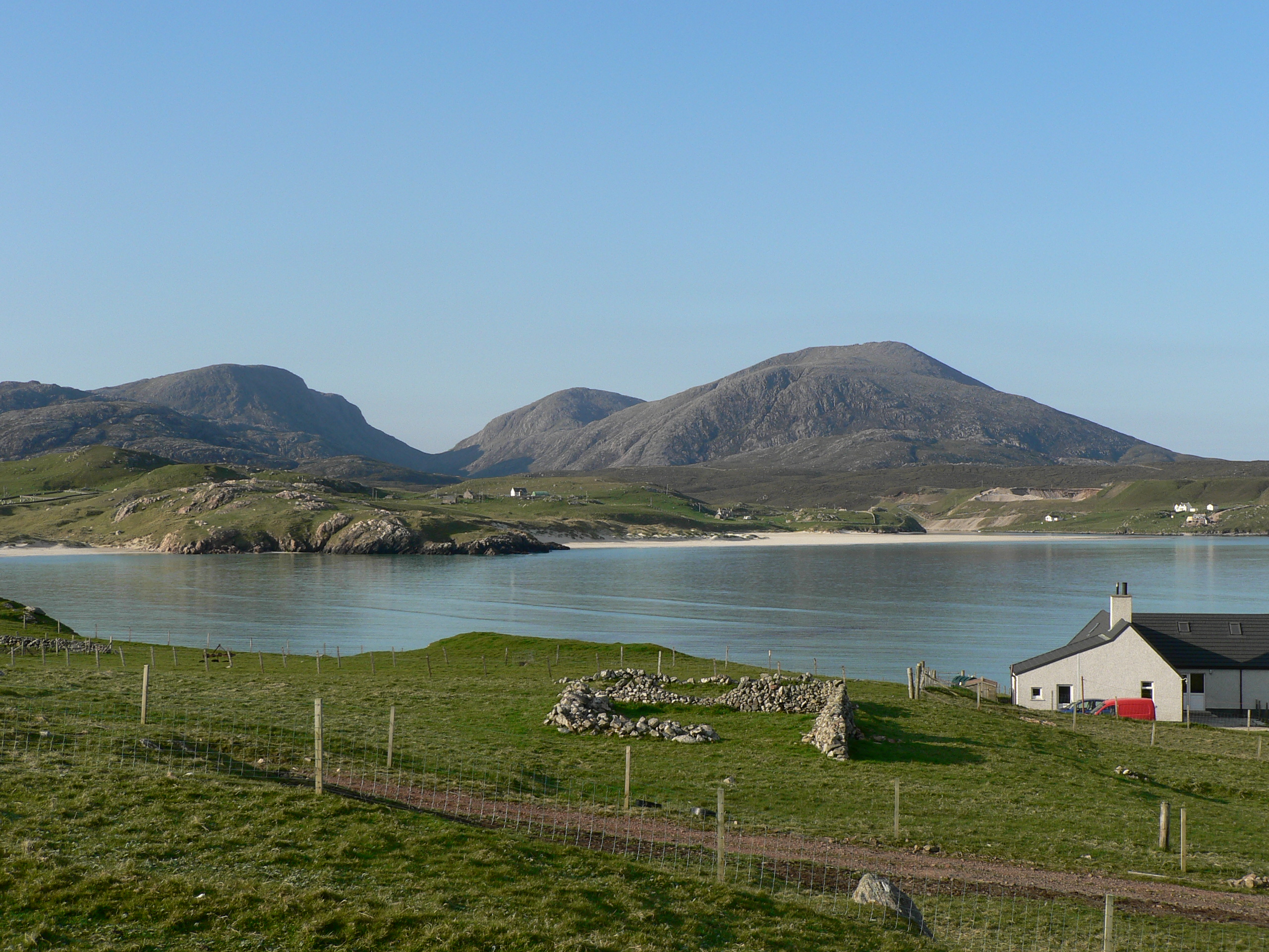
Near to the north-west promontory of Carlvay Bay [known to us as Loch Roag], called Galen-head, are the little islands of Pabbay, Shirem, Vacksay, Wuya, The Greater and the Lesser.
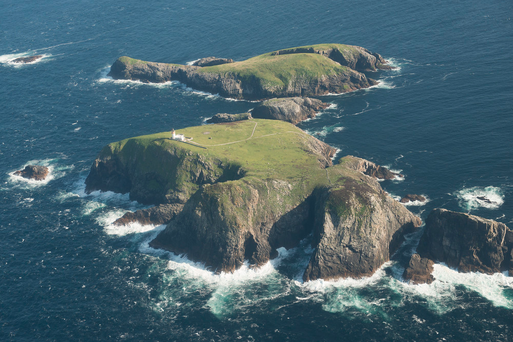
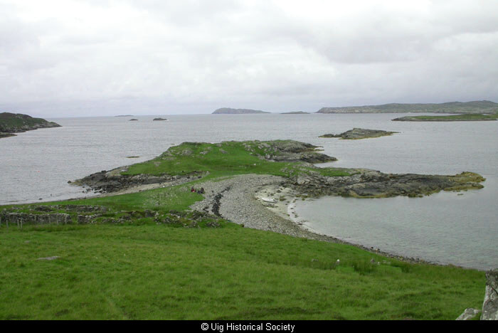
Fig. H1.7. Aerial view of the South end of Pabaigh Mòr from the north; Teampuill Pheadair is visible in the foreground above the sandy beach (SC 1093045, taken 25 Sep 2004. Crown Copyright: RCAHMS) 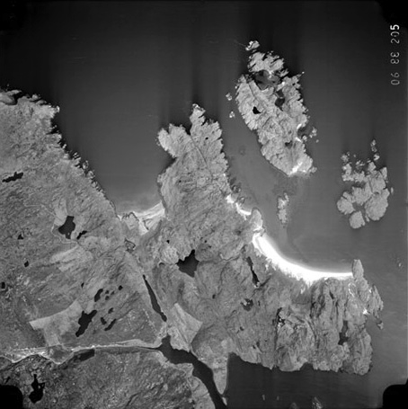
H1.5. Aerial photo of the Bhaltos and Cnip peninsula with Pabaigh Mòr lying to the north-east (Sortie 60688, Frame 205, taken 29 April 1988. © RCAHMS (All Scotland Survey Collection)
Pabbay Mor is an island located a few hundred metres off the shore from Valtos in Loch Roag.
The name, from the Norse, means Priest’s Island.
The smaller Pabbay Bheag is located to the north, opposite a spectacular lagoon.
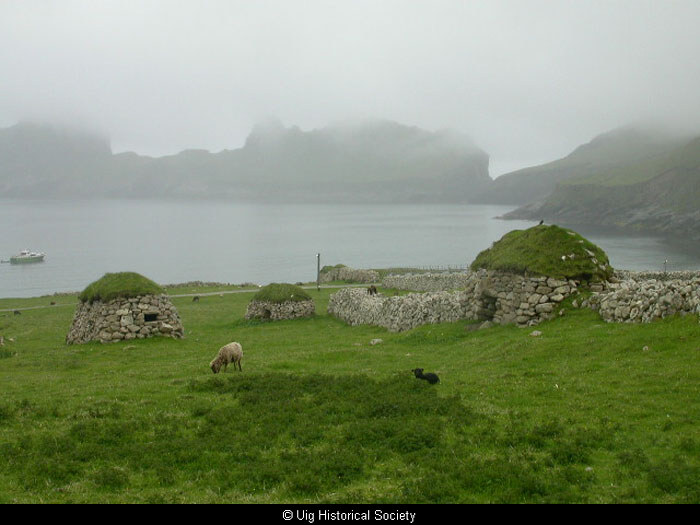
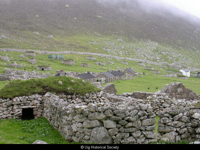
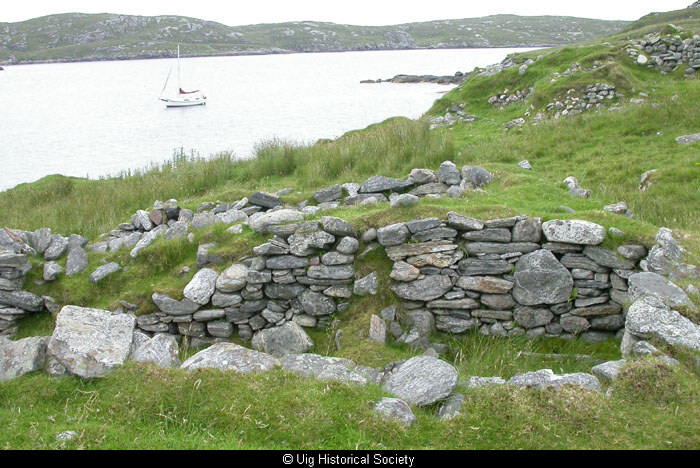
There are numerous archaeological sites here including:
The settlement at Briomanish and The mediaeval St Peter’s Church.
Vuia Mhor
The island of Vuia Mhor lies between Uig and Great Bernera, east of Reef, and covers an area of 84 hectares. The highest point is Mullach na Beinne (67m) which falls away to the sea at Creag na h-Iolaire (Eagle Cliff).
Records give four families living there in 1807, those of Murdo Maclean, Neil Macleod (ex Mangersta), Norman Nicolson and Roderick Stewart, each paying a rent of £4.0.9d annually. By 1841 there were seven families and some 46 people living there
If you would like to leave a comment or get in touch with us…
You can visit our facebook page Uig Historical Society where we will be able to contact you. We have a great facebook family who are always happy to help with anything from dates, photographs and any information regarding Uig.