Carnish Pier
no images were found
From an article by Dave Roberts with Norman Macaulay, John Macdonald and Donald Maciver.
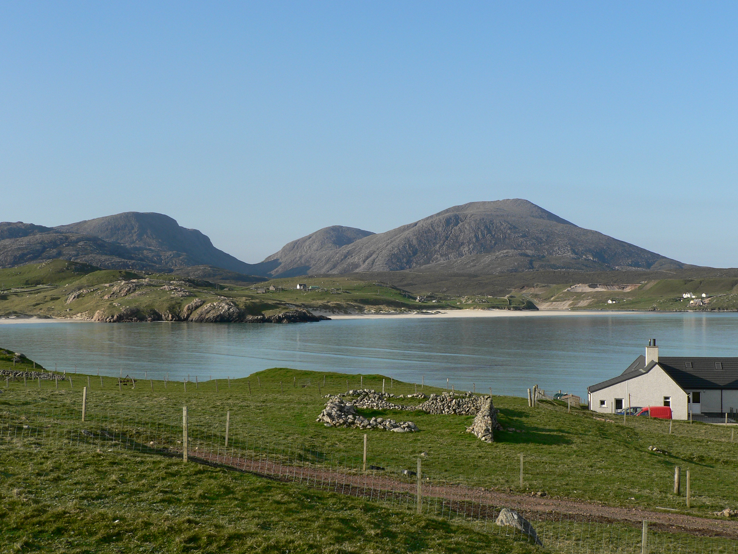
In the Seaforth Muniments, there are letters in which various people had recognized the need for a safe anchorage for the larger boats in Camus Uig. Representations were made to the Fisheries Board, and a plan and specification were prepared in 1835 for a pier at Carnish, with the completion date for the work set as 30 September 1836. There were plans for a road to be blasted through, a wharf wall and breakwater to be built, and a curing house to be constructed. The purpose was to shelter the bay at Mol na Duinn from the Atlantic swells and all but the easterly winds.
As the name implies, there was a dun on the headland close to the proposed site of the pier. As there is very little trace of this fortification nowadays, it may be assumed that the fabric of the dun was used in the building of the pier. The stone for the works was to be hammer-dressed, and lime and Roman cement to be used. The stones were to be drilled, and iron bars and bolts used to connect one block to the next. The courses were to be laid at an angle to the sea, so as to deflect the full force of the waves. Finally, a parapet with copingstones was to be bolted onto the top. The cost was estimated at £1,810, of which the Fishery Society would provide two-thirds and the Estate were to pay the rest.
Among the Lighthouse Stevenson papers at the National Library are the reports from the Fisheries Board, in which the engineer Joseph Mitchell says that when he inspected the works in 1837 they were satisfactory considering the material available to the contractor James Bremner of Wick. The stone was sufficiently strong, but difficult to work into neat masonry.
However, on the first edition OS map, dated 1854-1858, there is a dun marked on the point (on a tidal island) but there is absolutely no mention made of a pier, or even a ruin of one, although the surveyors were staying nearby at the farmhouse at Capadal. In the “Name Book” for the parish of Uig, which included more detail, there is an entry in describing “a small prominent rocky promontory on the south shore of Camus Uige. It is connected with the shore by a narrow neck of rock and sand, over which a rude stone bank or pier has been built to accommodate smaller boats in their landing”. In different handwriting it says “the attempt to build a pier has been abandoned – no Castle nor Fort on it….”
They seem to imply that, contrary to the engineer’s report of 1837, the pier was only partially built and then abandoned, so that there was enough structure to provide for small boats, but never a complete pier as was planned, for the larger boats. Certainly the mapmakers noted that Mol na Duinn “was sheltered and had the appearance of a tolerably good port, the water at its mouth is pretty deep”.